Viðareiði

After the epic heli-flight I unpacked my gear with a lot of enthusiasm and eagerness to venture outside the airbnb ASAP. I had to book the room for two nights because it is impossible to do the planned activities in the northern part of the archipelago and come back to Torshavn to sleep. Stationing myself in Klaksvik was an excellent decision; the city itself is a definitive highlight of the entire trip and for sure I shall be returning there.
The day before I estimated that after the flight I could take a short bus ride to the Viðareiði village (Vidareidi, for the sake of Google), explore it properly, and come back to Klaksvik by taking the last bus from Viðareiði.
I cannot emphasize enough how happy I am that I did that.
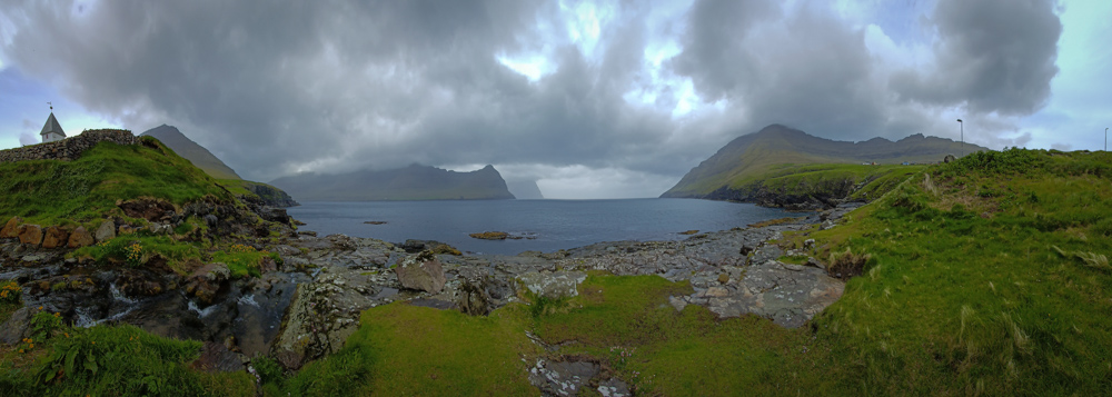
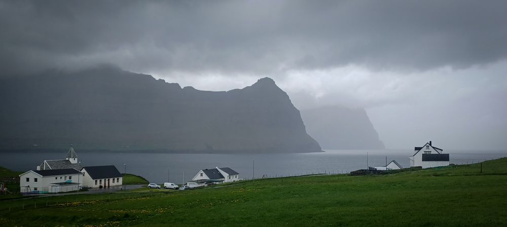
Viðareiði is out of this world beautiful and quite remote. You do not come here by accident; it takes a lot of time and a lot of layovers to reach it. But, it is extremely gorgeous, almost poetic and ethereal. Walking through it, especially on a day with the weather that I had, was an experience that I needed, a feast for all senses.
The rain started in Klaksvik and continued in Viðareiði. I am heavily armed to withstand all sorts of weather calamities and a drizzle is something which can only bug my technical equipment.
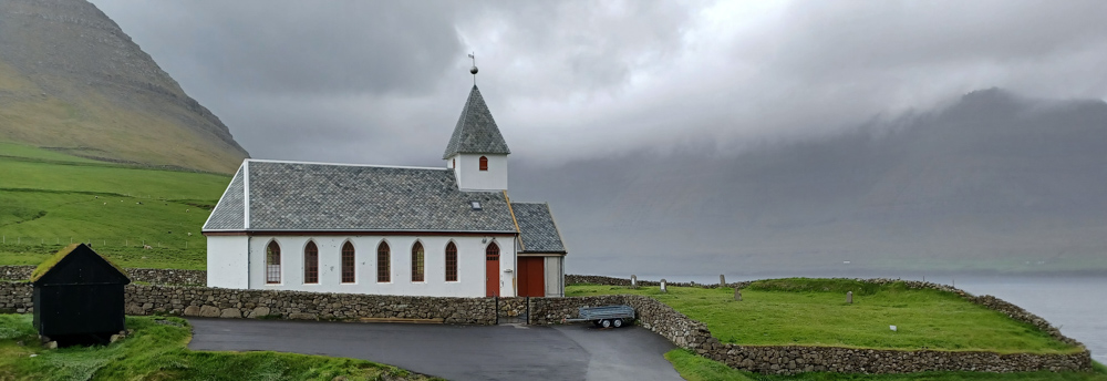
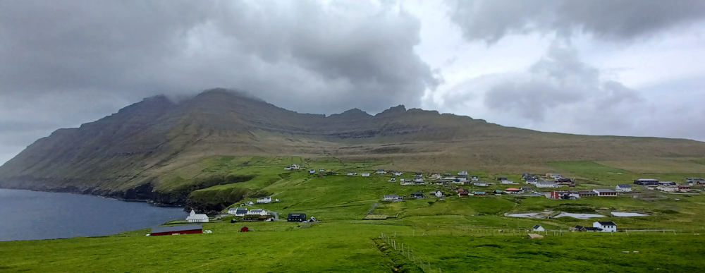
Look how Viðareiði looks like.
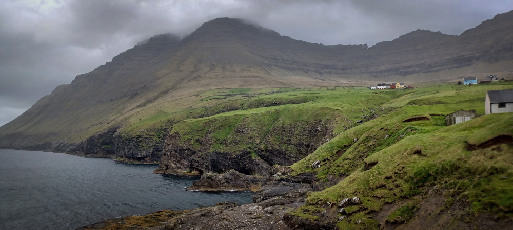


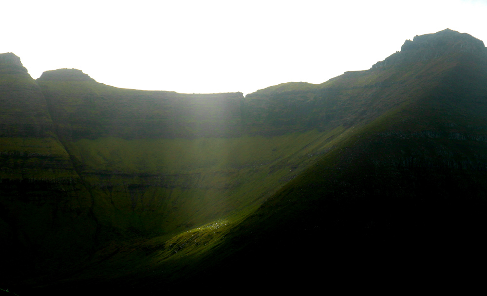
These last two images are very special to me.
The first one shows the mountain above Múli. I have no idea how I managed to take this photo. Múli is a hamlet on the on the outermost northern edge of Borðoy’s east coast. The origins of the settlement can be traced back to the 14th century. Múli became the last community in the archipelago to receive electricity in 1970. Múli was one of the remotest settlements in the Faroes – there was no road link until 1989, before which goods had to be brought in via helicopter or boat. The last people left in 1994.
And the last one depicts a spot I took dozens of pictures of. The fog was back and forthing the entire time I was there and it hid and revealed this spike edge on the island behind it. It is the northernmost peak of a very special island, the one which is my personal sweet spot here in the Faroe islands, Kunoy.
Beside that, Viðareiði holds the northernmost point award – cape Enniberg, a second highest cliff in the world, lying on the end of Villingadalsfjall. Heavily impressed by this spot, I was investigating hiking routes to it and considering hiring a guide as it is known to be risky and dangerous but I had no idea how dangerous it is. Now I know. I spent 3h in Viðareiði during which the local weather showed me, finally, its true face. It changed 87 times and decided to stop at the heavy rain station. Which I do not mind at all, by all means, I came here to be ridden hard by Nature and put away wet (literally). Viðareiði lies in a valley between two mountains, Villingadalsfjall and Malinsfjall, surrounded by sea on two sides, called an isthmus, and the wind was BRUTAL, to me, on the ground. I cannot even imagine how crazy it has to be on the cape Enniberg hike up there. So, having an everchanging and unpredictable weather on the menu, served with very steep slopes and hiking “path”, I can wholeheartedly recommend to anyone aiming at hiking there and reading this – do. Not. Go. Alone. There. And be prepared as best as you can for this excursion.


